Project Background
During community consultation in 2022, the need for traffic calming treatments on Penkivil Street, Bondi was raised.
A local area traffic management study, carried out by professional services consultants GHD, analysed various data sources to identify issues of concern, which included traffic speeds and a high fatality and serious injury probability risk.
Traffic Speeds
An analysis of the 85th Percentile Speed Distribution from the Compass IOT data indicate that speed of over 50km/h occur on short sections of Penkivil Street.
Occasional speeding has been witnessed along Penkivil Street, with a long straight stretch of the road between Bondi Road and Old South Head Road.
High fatality and serious Injury probability risk
The study revealed additional high fatality and serios Injury probability risk (FSI) probability on Penkivil Street. This data can inform – in conjunction with other data and considerations (crash history data and findings from site visits and community) – where opportunities for the installation of traffic management treatments may be recommended to improve safety for traffic and vulnerable road users.
Key concerns of residents about this location:
- Speeds exceeding 50km/h occurring on short sections of Penkivil Street
- Five vehicle crashes recorded along this part of the road (NSW Centre for Road Safety 2018- 2022)
- Minimal to no traffic calming measures currently present
- 85th percentile speed (mid-block): 45 km/h (Source: Compass IoT) (Simpler explanation)
- High risk of injury identified (Source: Compass IoT)
What is compass IOT data?
Compass IoT data refers to anonymized and aggregated connected vehicle data collected and analysed by Compass IoT, an Australian road intelligence company. This data is used to improve road safety, infrastructure, and city planning. It's collected from a vast network of vehicles, providing insights into road conditions, traffic flow, and driver behaviour without identifying individual drivers
Image 1 of 8
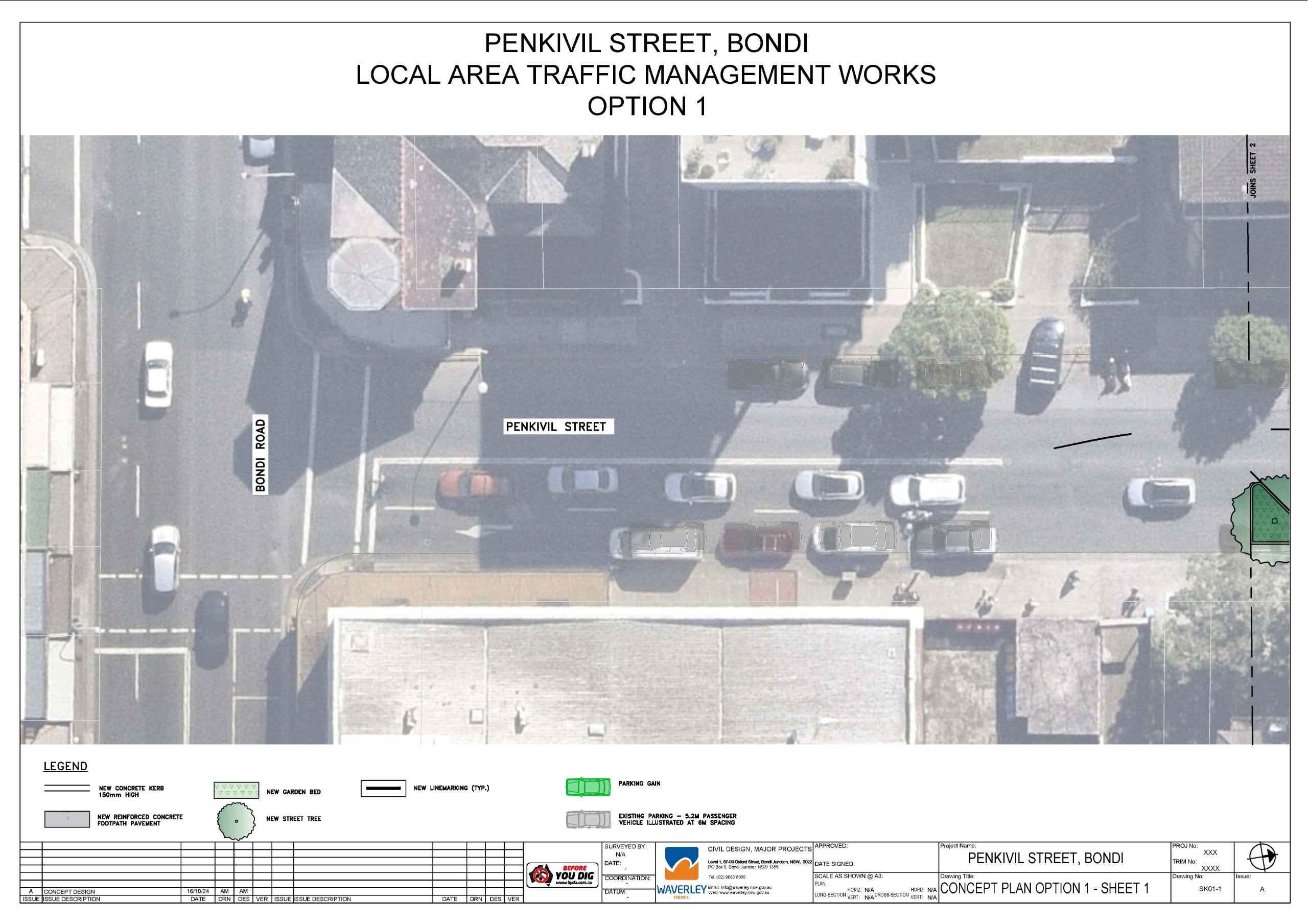
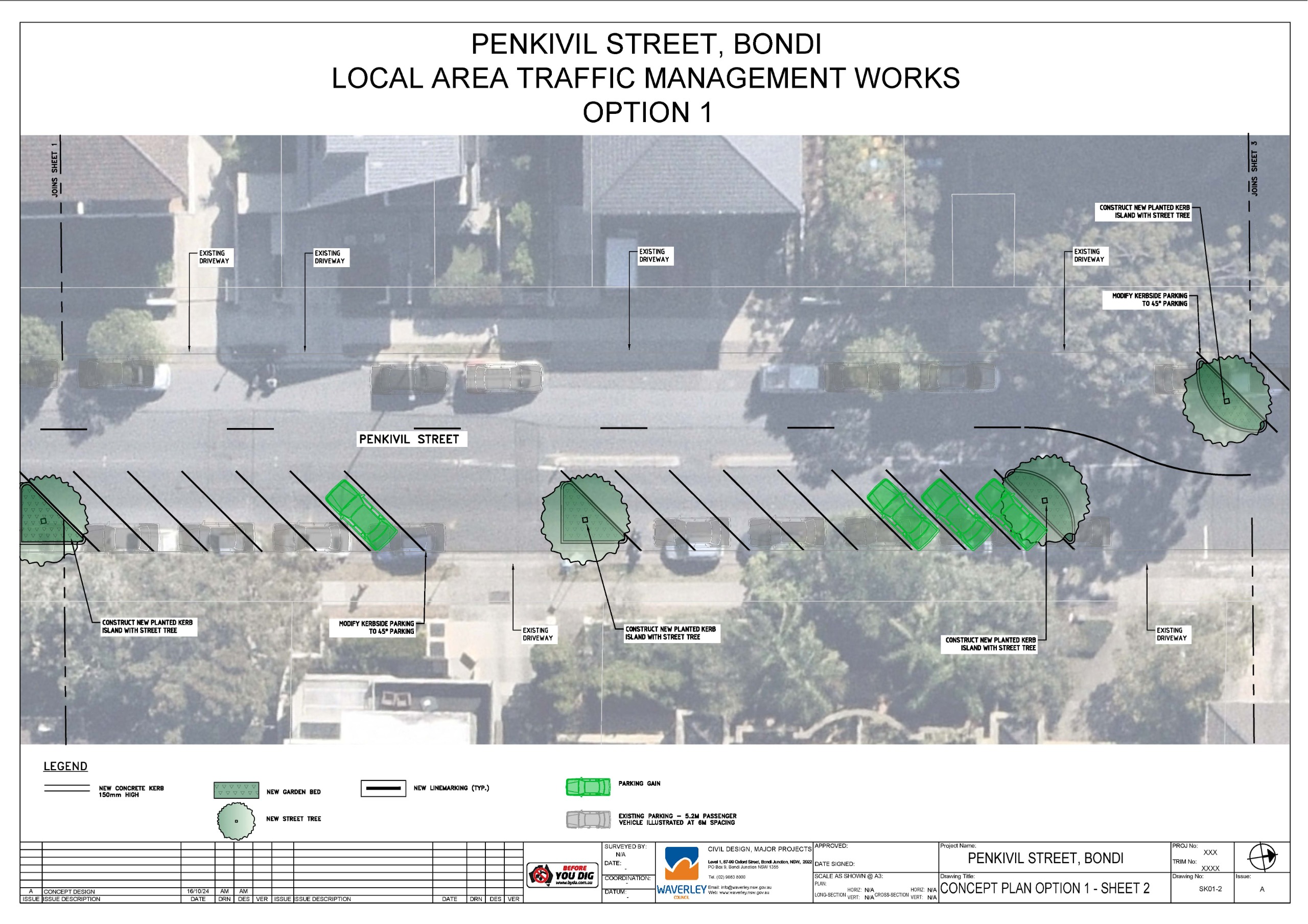
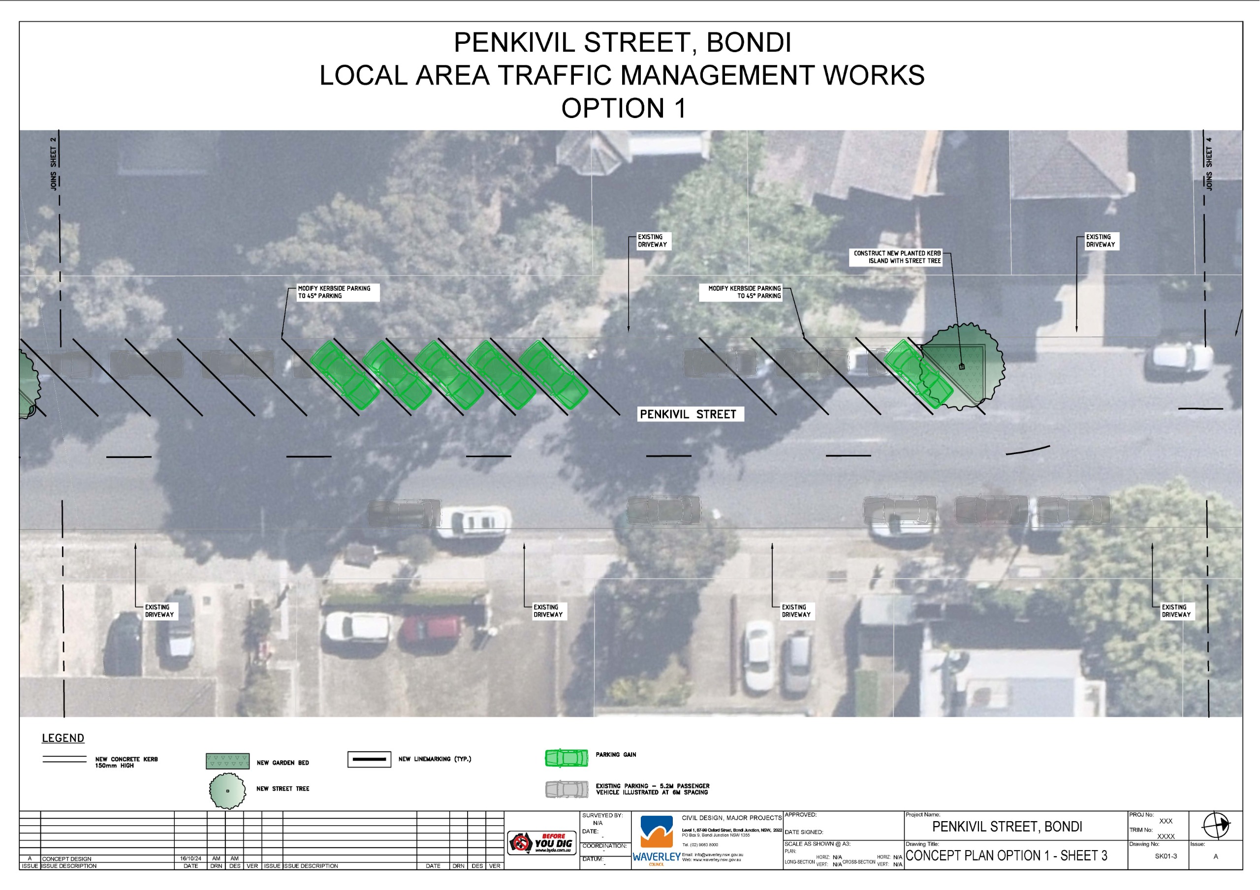
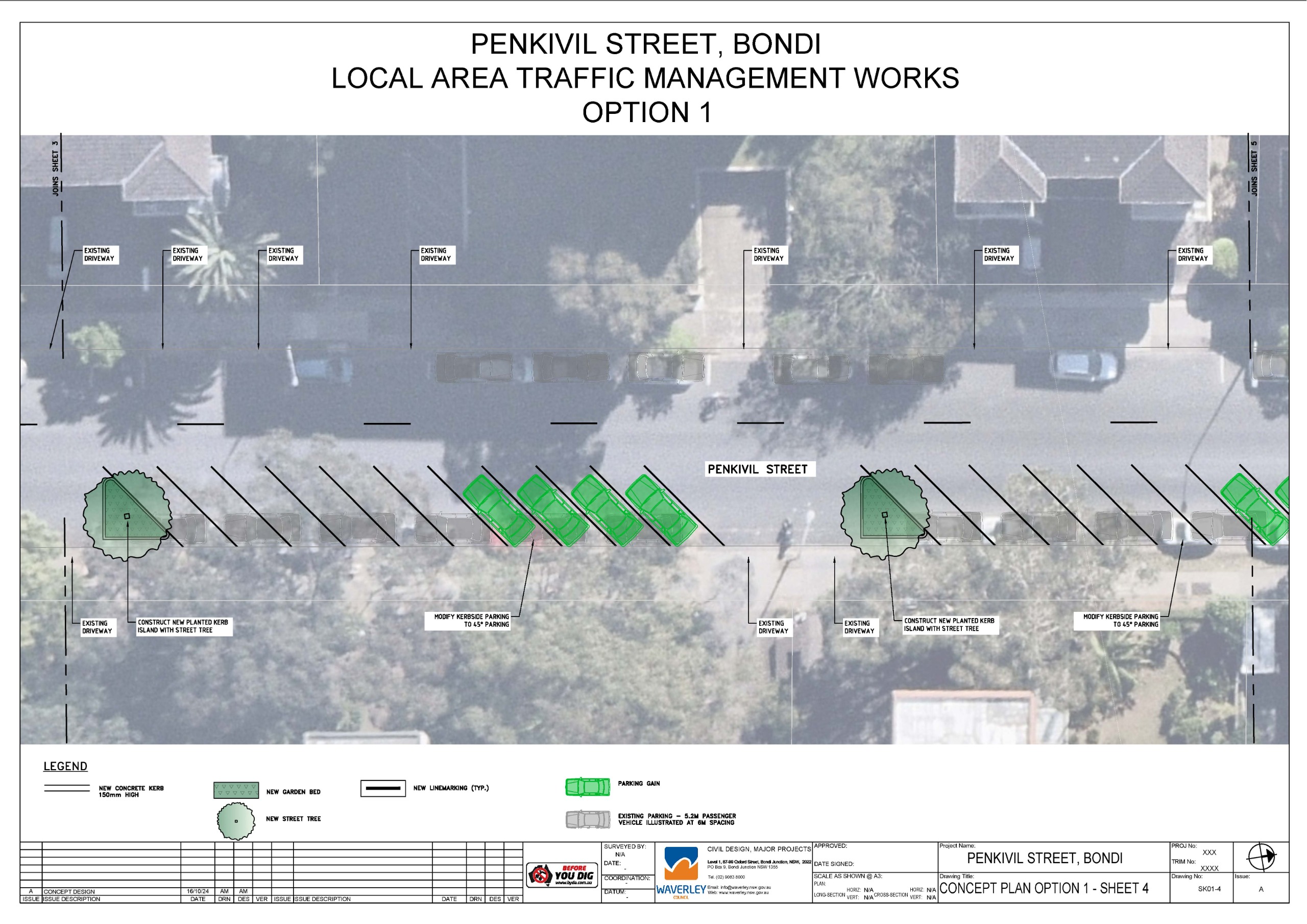
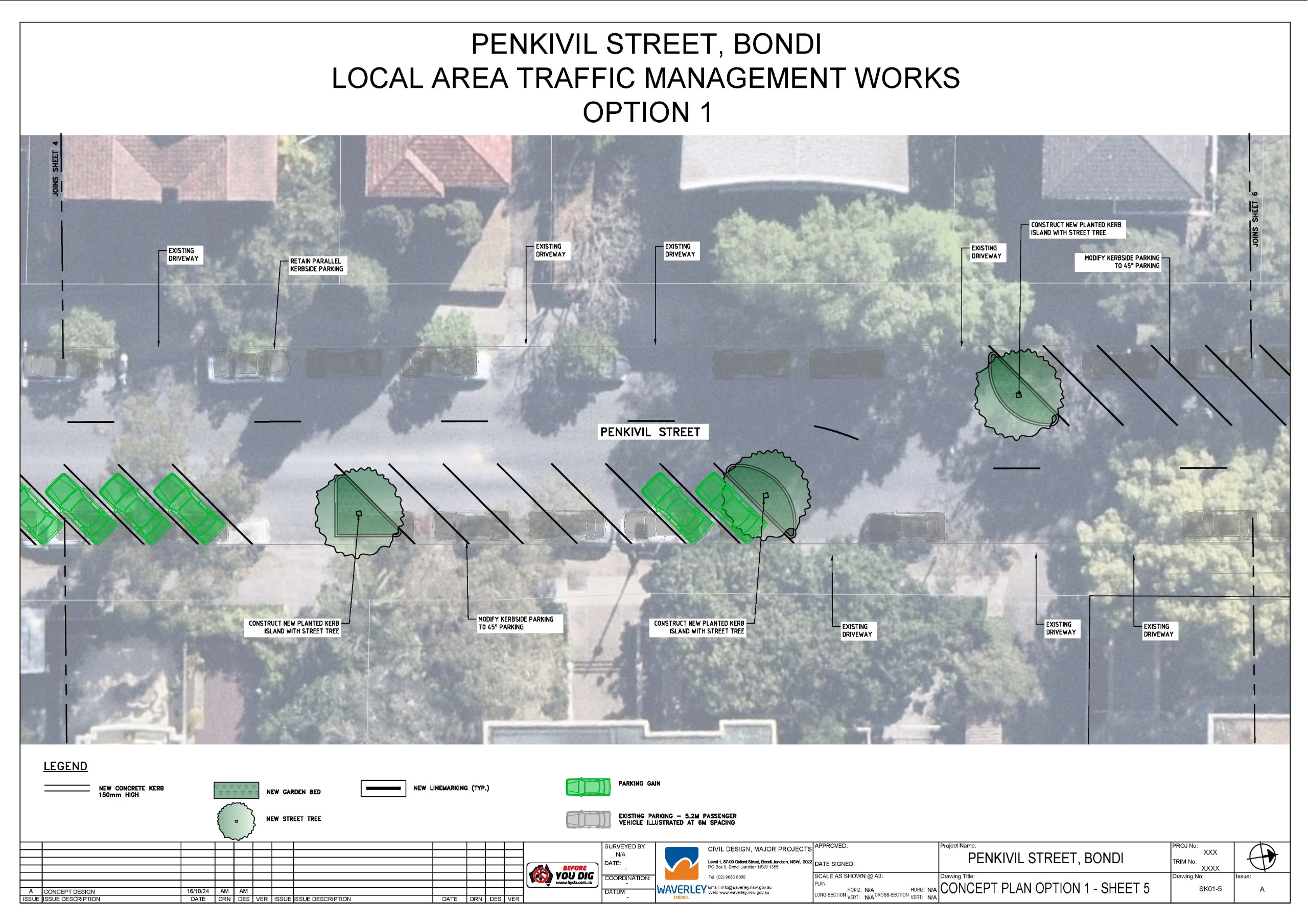
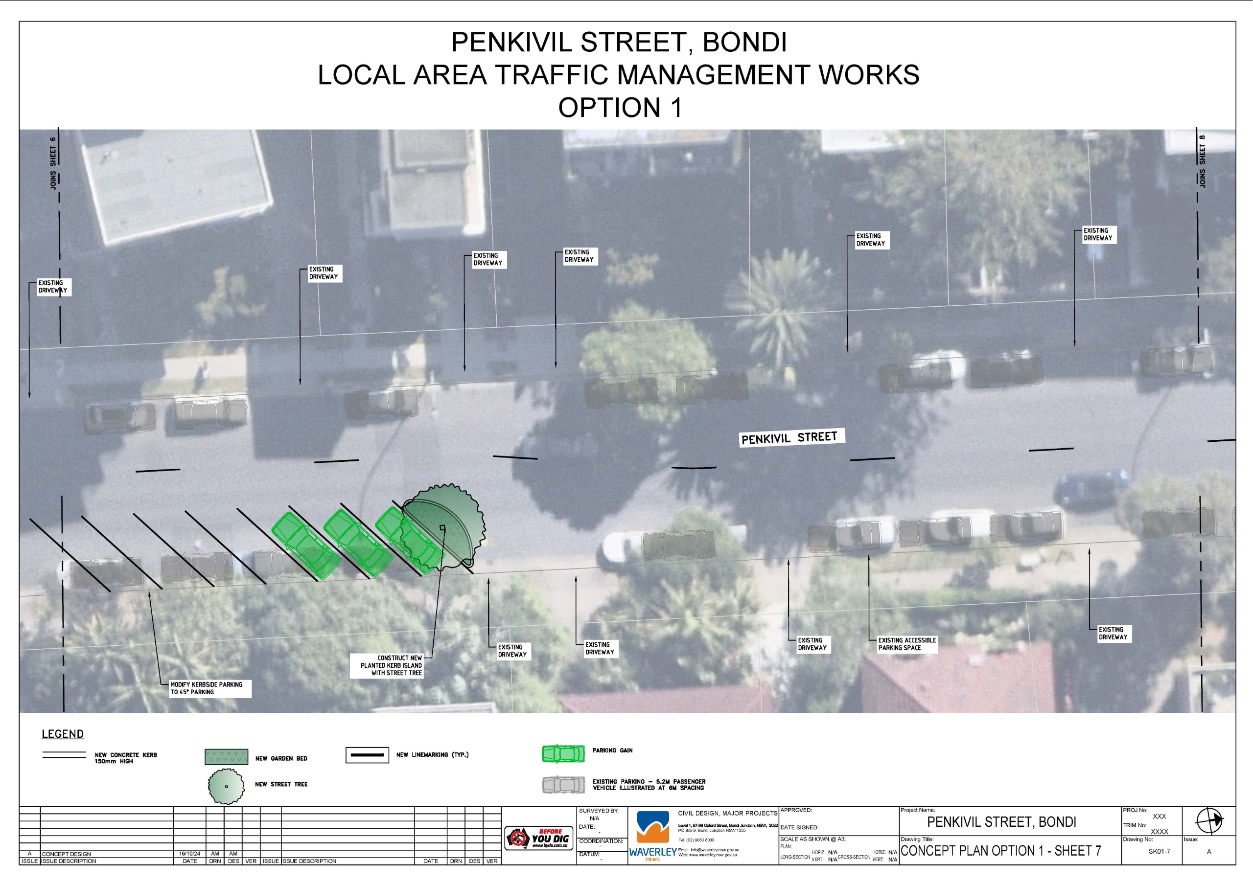
- Alternating sections of existing parallel parking modified to 45° angled parking, this provides traffic calming through slowing vehicles with a narrowing of the roadway. This also increases the available parking supply by approximately 27 additional car parking spaces.
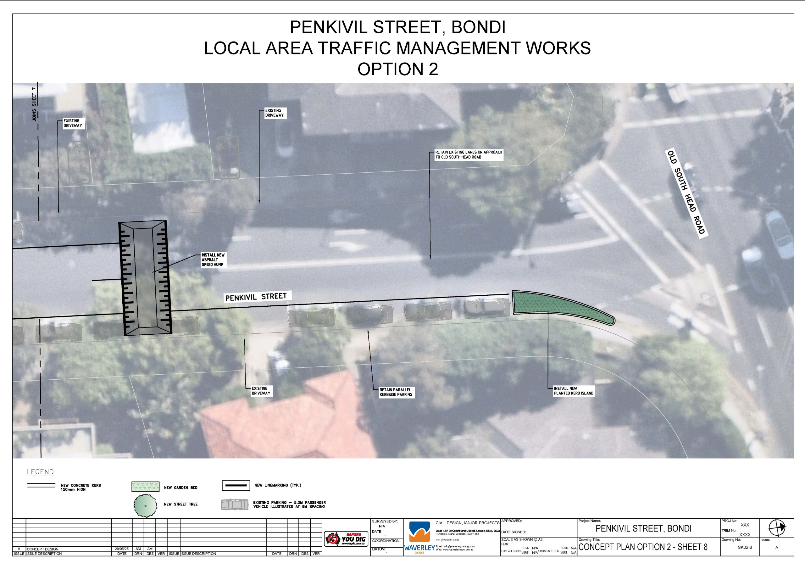
- New planted kerb islands with opportunity for street trees. These will provide traffic calming, slowing vehicles by narrowing the roadway. They also improve visibility for all road users, particularly as people often cross at these locations. Providing extended areas of kerb allows for drivers to better identify pedestrians about to cross, and pedestrians to better identify a driver before they cross. There is concern that street trees limit visibility, however, this is dependent on species. This is to be determined in the detailed design phase.
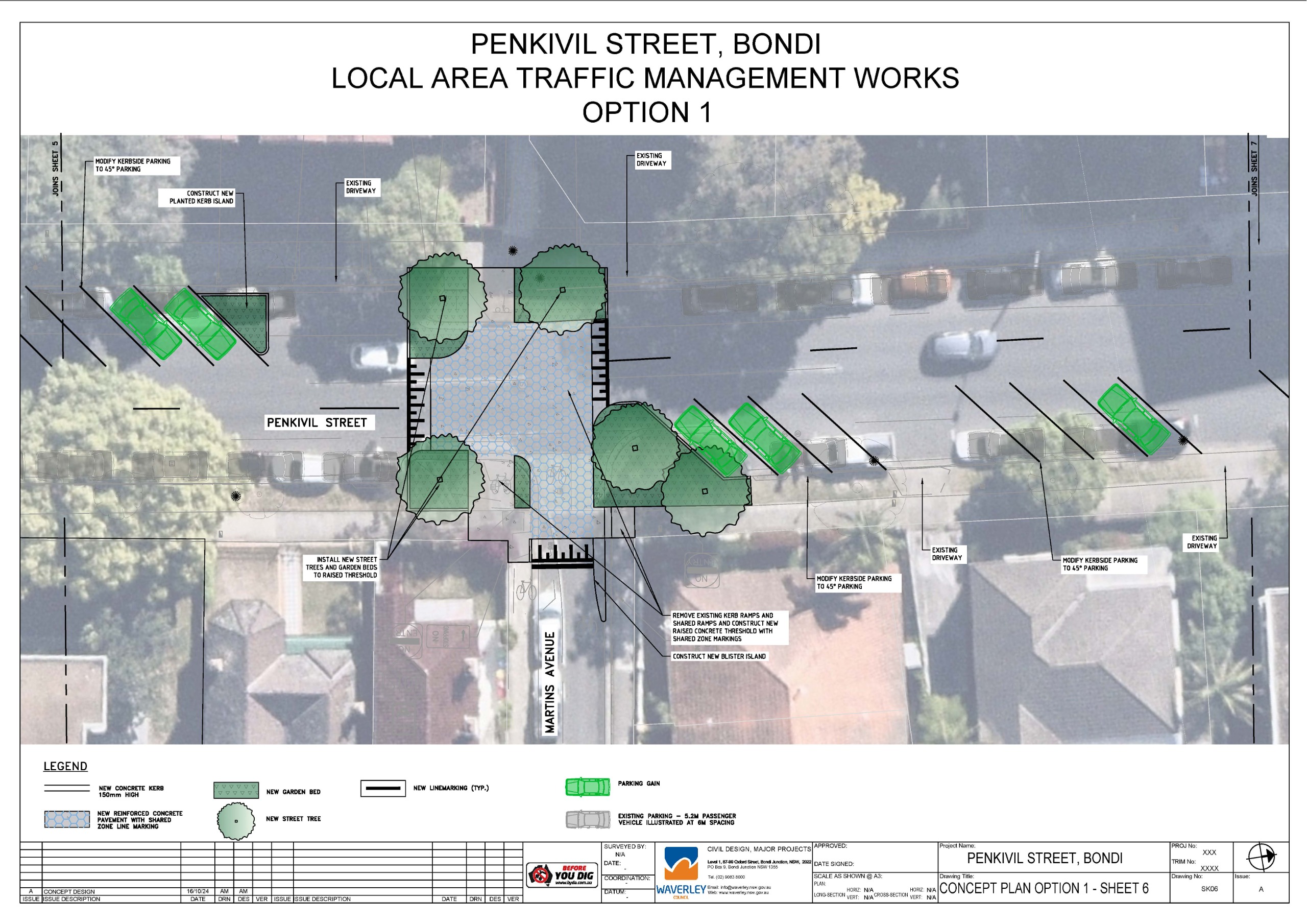
- New raised intersection treatment at Martins Avenue with pavement markings indicating a shared zone for pedestrians, bicycles and vehicles. A raised intersection slows down all traffic as vehicles must navigate a vertical rise, and prioritises active travel modes (cycling, walking, etc.). This lowers the risk and severity of an accident.
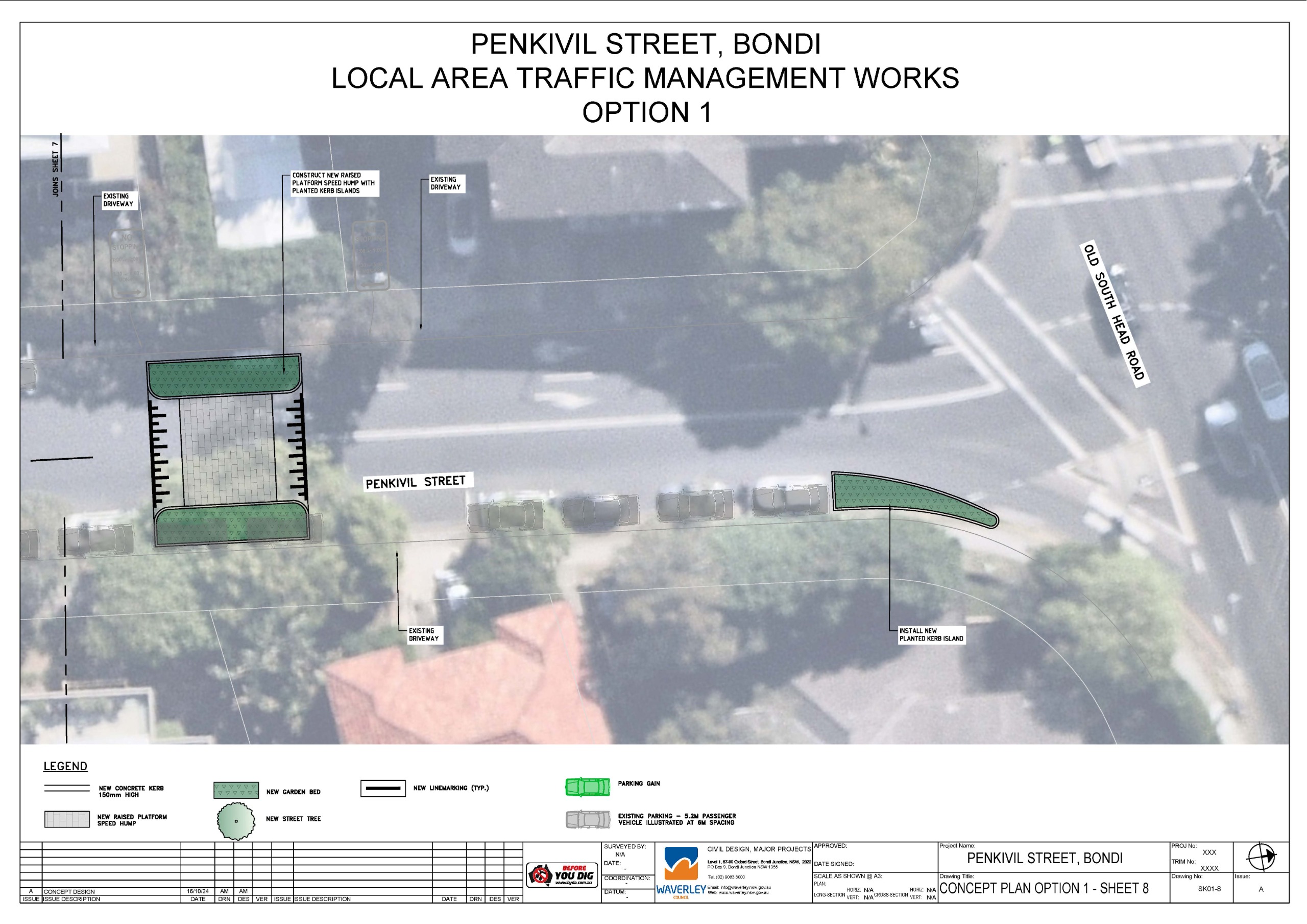
- New speed hump (near Old South Head Rd), Speed humps introduce a gentle incline for drivers to navigate. This requires a reduction in speed, minimizing the risk and severity of accidents on the road.
- Opportunity to incorporate dedicated bike share parking pods at Penkivil Street south near Bondi Road, at Martins Avenue and Penkivil Street north near Old South Head Road. Dedicated bike share pods allow an area where bikes can be parked so they do not impact the available footpath width. This improves accessibility for pedestrians.
Image 1 of 8
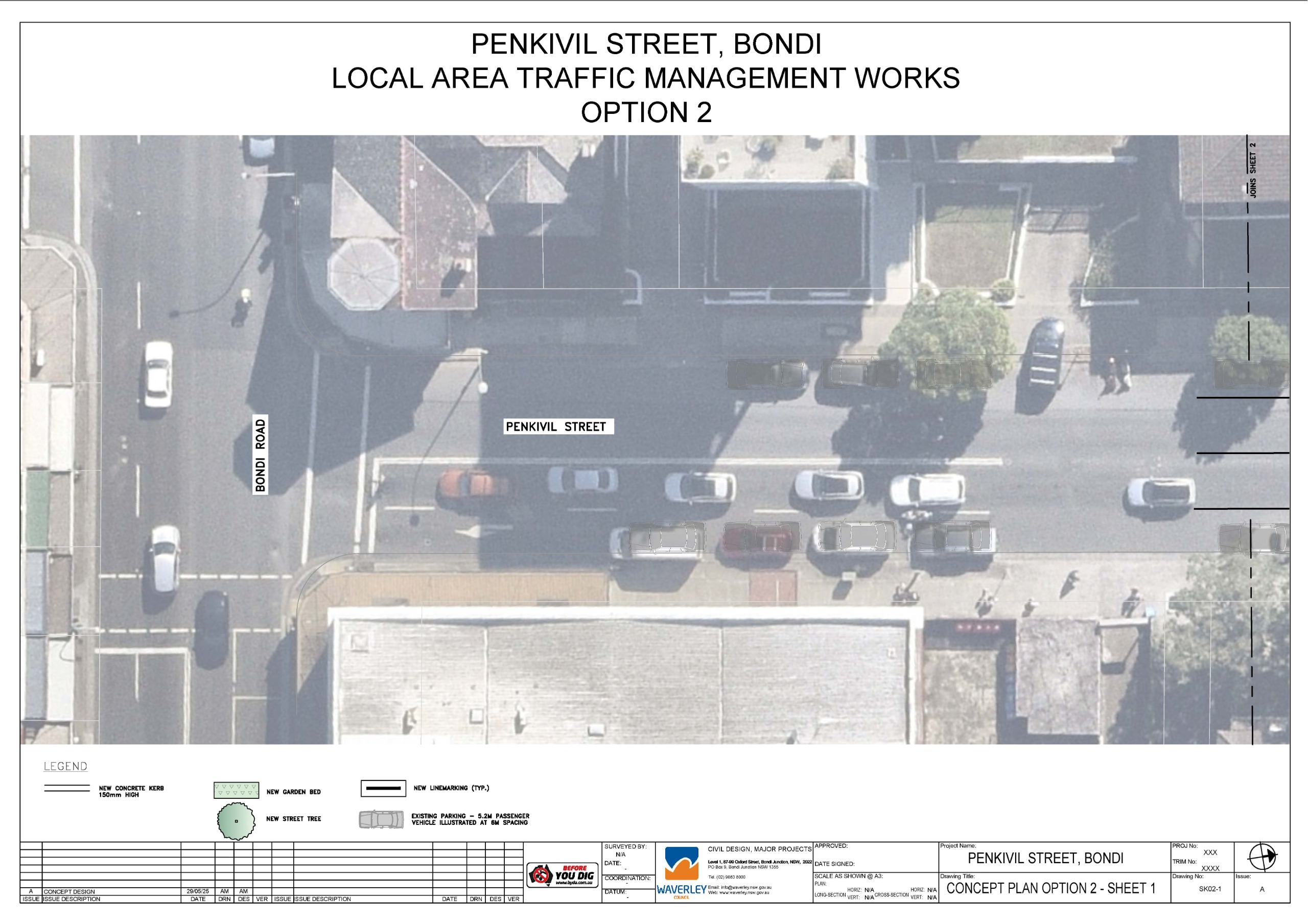
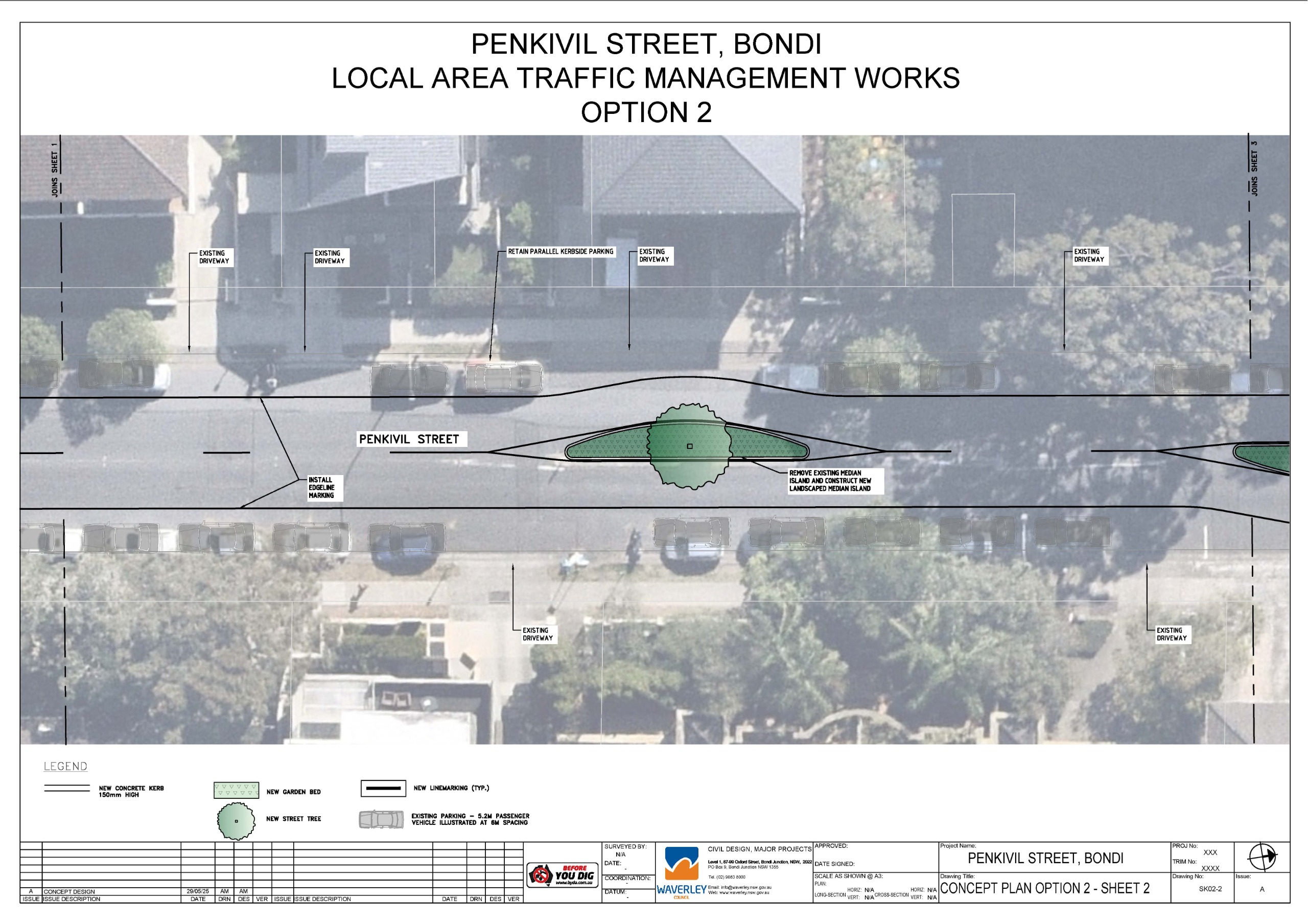
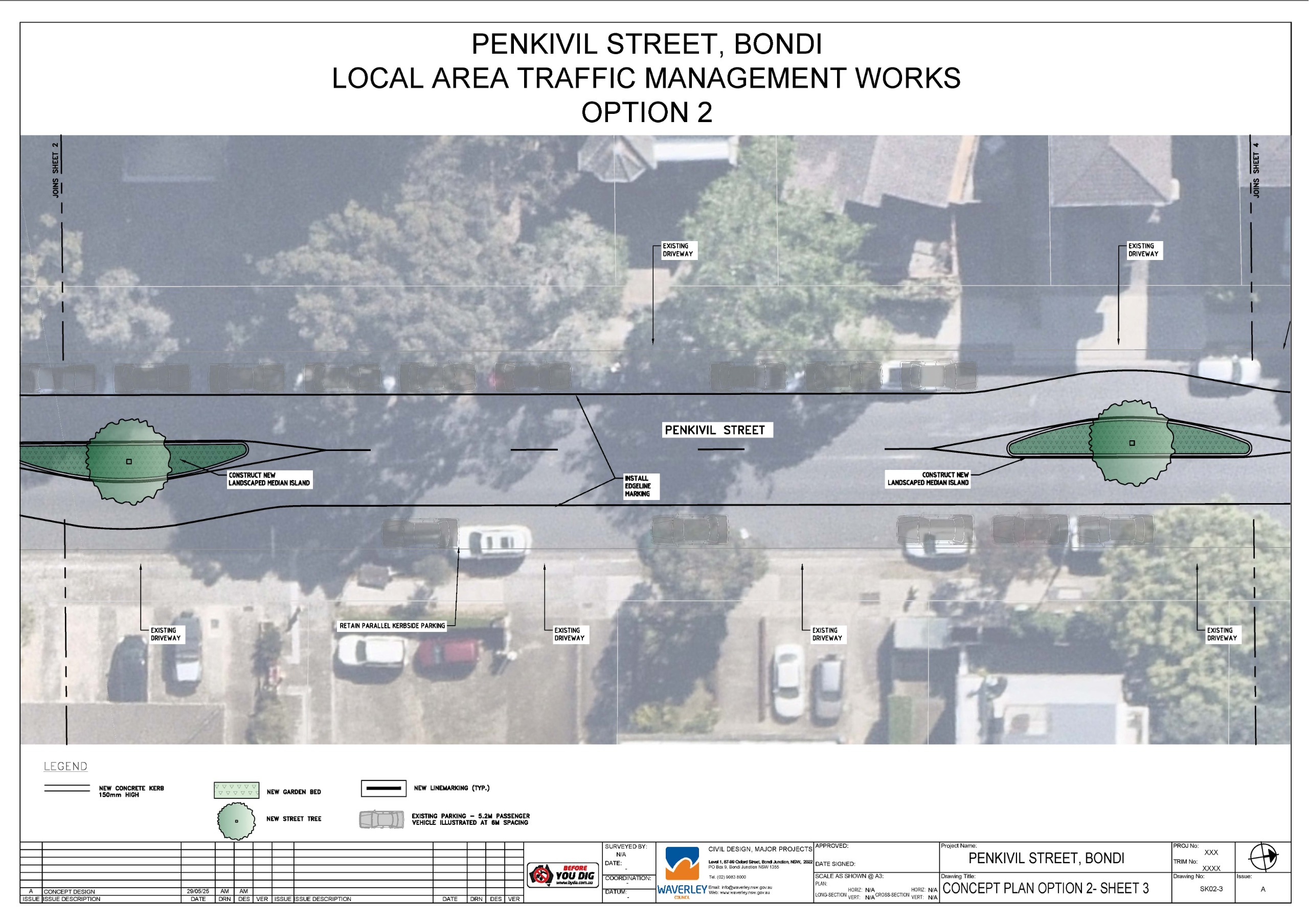
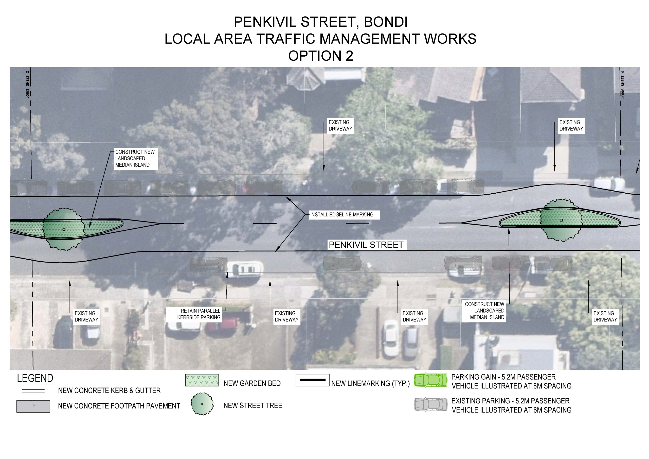
- New landscaped median islands with opportunity for street trees. Medians provide traffic calming through a visual and physical narrowing of the roadway. This encourages lower vehicle speeds, reducing the risk and severity of an accident.
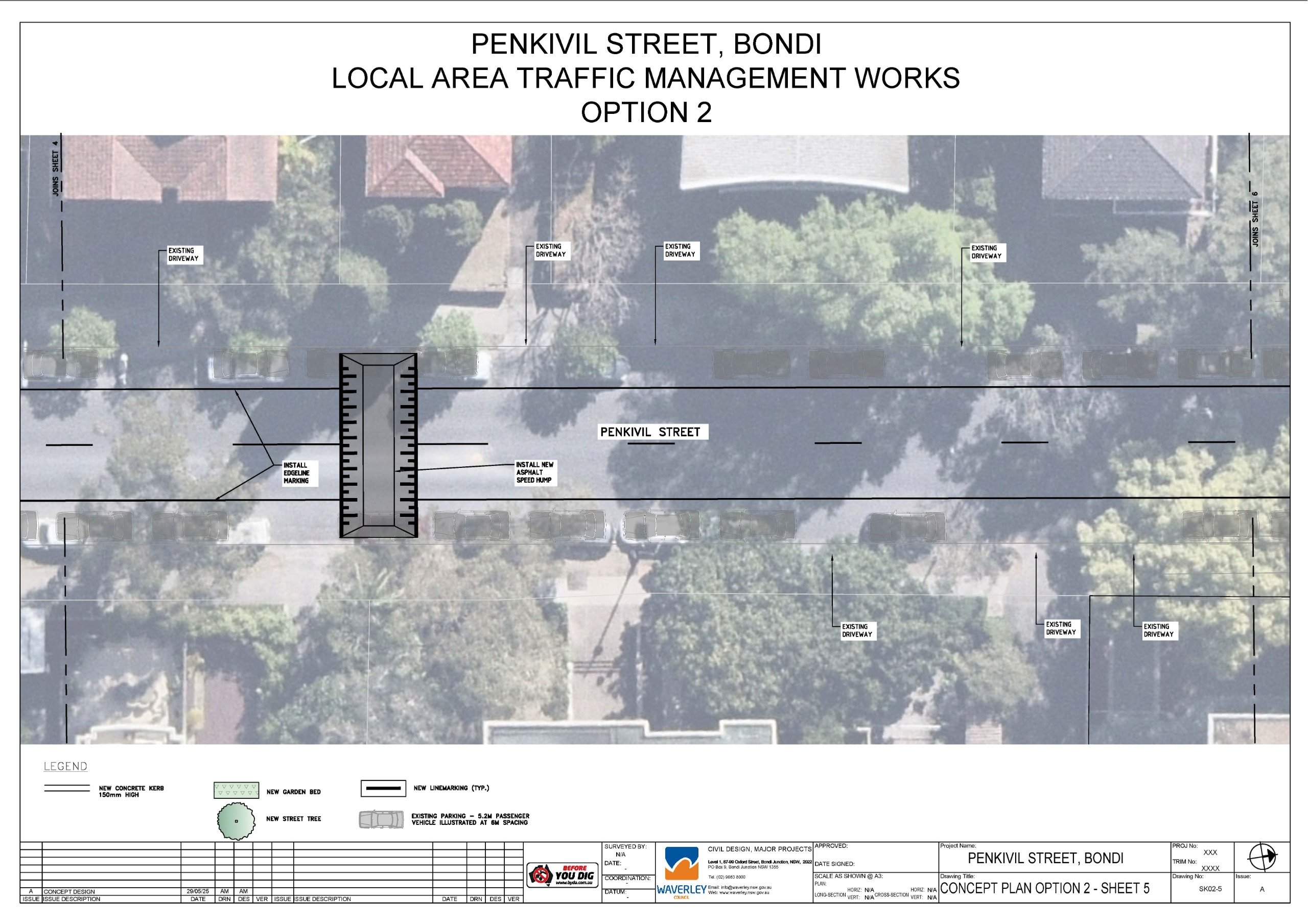
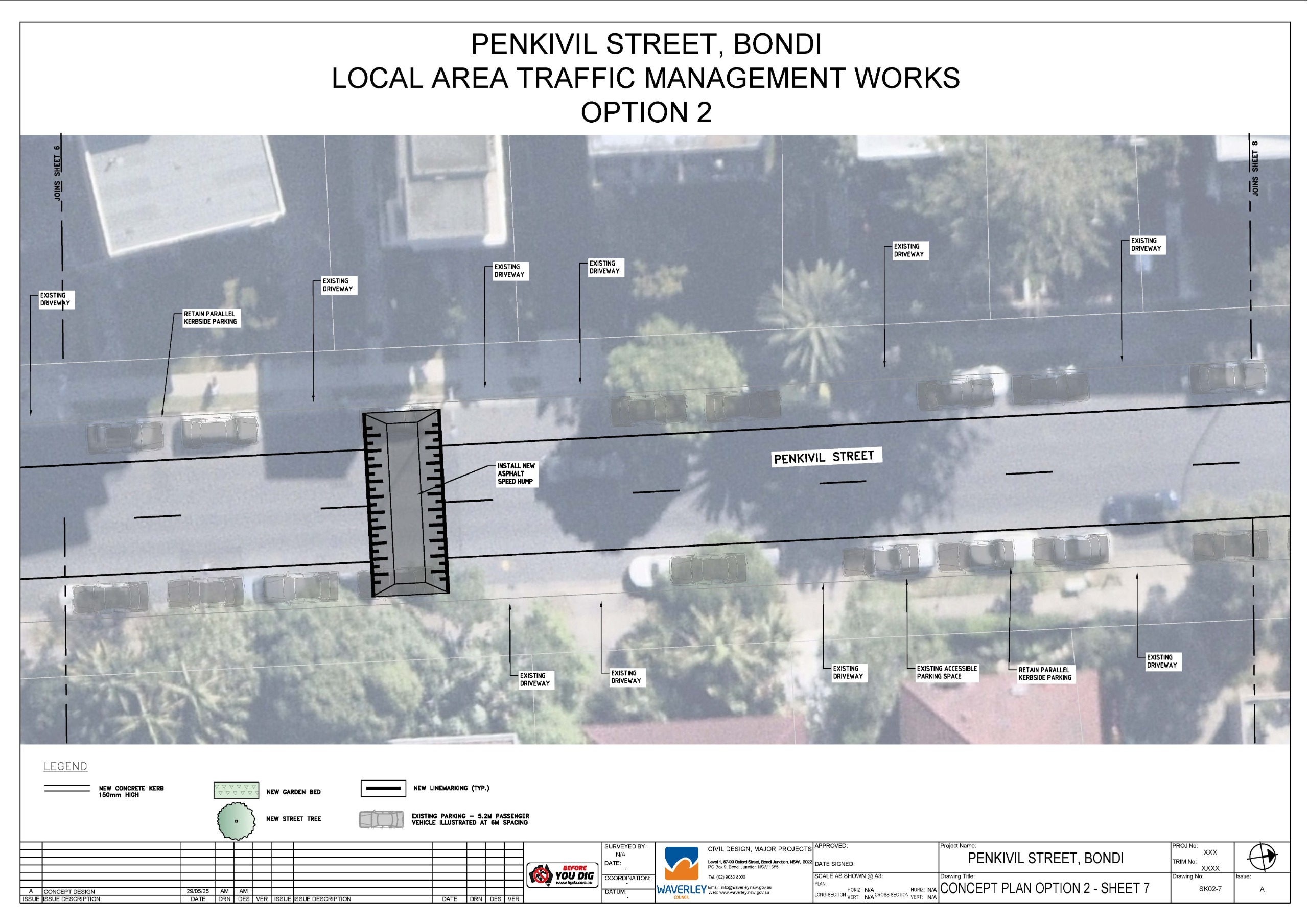
- New speed humps. Speed humps introduce a gentle incline for drivers to navigate. This requires a reduction in speed, minimizing the risk and severity of an accident.
- Narrower traffic lanes through edge line marking. Narrower traffic lanes encourage slower vehicle speeds, as drivers do not feel as comfortable travelling at high speeds.
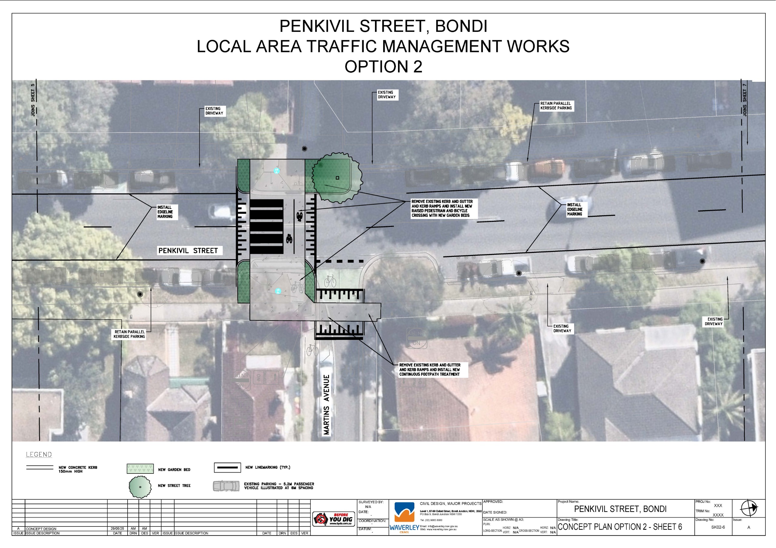
- New raised pedestrian and bicycle crossing across Penkivil Street at Martins Avenue. Raised crossings slow down traffic in a similar way to a speed hump, making vehicles slow down to navigate the vertical rise. They also provide priority for pedestrians and cyclists, as drivers must give way.
- New continuous footpath treatment (CFT) at Martins Avenue. CFT’s slow down traffic in a similar way to a speed hump, making vehicles slow down to navigate the vertical rise. They also provide priority for pedestrians, as drivers must give way.
- New garden beds and opportunity for street trees at Martins Avenue. These will provide traffic calming, slowing vehicles by narrowing the roadway. They also improve visibility for all road users, particularly as people often cross at these locations. Providing extended areas of kerb allows for drivers to better identify pedestrians about to cross, and pedestrians to better identify a driver before they cross. There is concern that street trees limit visibility, however, this is dependent on species. This is to be determined later in the detailed design phase.
- Opportunity to incorporate dedicated bike share parking pods at Penkivil Street south near Bondi Road, at Martins Avenue and Penkivil Street north near Old South Head Road. Dedicated bike share pods allow an area where bikes can be parked so they do not impact the available footpath width. This improves accessibility for pedestrians.


